SWITZERLAND
BRIDGES
|
ALL ABOUT SWITZERLAND |
|
RHINE BRIDGES |
|||||
Swiss Cities Basel · Minster/Cathedral · Medieval Gates · Paulus Church · St. Anthony Church · Tinguely Fountain · Rhine Bridges · Rhine Ports · Basilisk Bern Geneva Lausanne Lucerne St. Gallen Winterthur Zurich Alpine Resorts Bernese Oberland Zermatt/Matterhorn Swiss Tour Chillon Castle Rhine Falls |
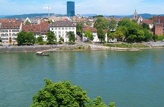
The city of Basel is a traditional Swiss bridgehead on River Rhine. A couple of bridges connects Grossbasel (south) and Kleinbasel (north). There are also four little ferry boats, operated for tourists' fun only, however. Münsterfähre - Rhine FerryboatBetween the cathedral and the right shore there is a traditional passenger ferry boat. Access from the right shore is relatively easy from Oberer Rheinweg, while you have to descend (or mount) a couple of steep stairs on the Cathedral / Pfalz side.
How to get thereGPS coordinates: latitude=47.557530 longitude=7.593398, map by google |
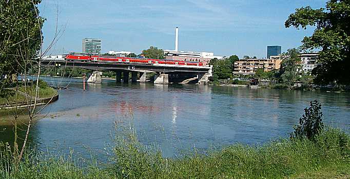
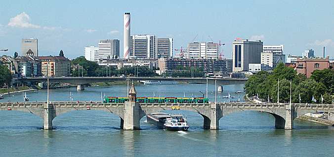
Schwarzwaldbrücke [Black Forest Bridge]
and River Birs flowing into River Rhine.
Schwarzwald bridge combines a 4-lane motorway, a local highway and a doubletrack railway bridge.
A second double track railway bridge is being planned.
Traffic is mainly from and to Germany as the bridge is located at the city's east end.
Wettstein Bridge (seen from the
Pfalz / cathedral,
looking upstream)
The bridge as well as Wettstein place on the right shore are named after Basel's mayor Johann Rudolf Wettstein (1594 - 1666). Wettstein represented Switzerland at the 1648 peace conference following the great European war. Thanks to Wettstein, Switzerland reached international recognition as an independent nation in this treaty after 150 years of de facto independence from the German empire following the Swabian war in 1499.
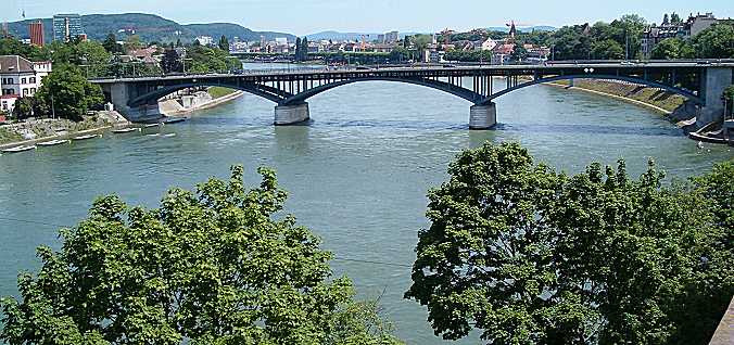
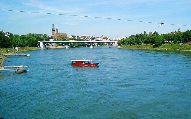
Mittlere Brücke (foreground) and Johanniterbrücke
(Seen from Wettsteinbrücke, downstream)
Mittlere Brücke is Basel's oldest bridge connecting the medieval parts of Grossbasel [greater Basel] on the left shore and Kleinbasel [smaller Basel] on the right shore. Passing under this bridge is a real challenge for freight ships and captains without a special local license have to hire a local pilot for the passage.
Right shore of Mittlere Brücke, downstream side.
Trams 6, 8, 11, 14, 15, 16, 17 to stop Schifflände, then cross the bridge or
trams 6, 8, 14, 15, 17 to stop Rheingasse and walk back to the bridge.
GPS coordinates: latitude=47.560700 longitude=7.590700, map by
google
Another ferry boat connects the left shore medieval St. Alban-Vorstadt district
(St. Alban Rheinweg) with the right shore (Schaffhauser Rheinweg / Fischerweg).
Access to this ferry boat is easy from both sides.
St. Alban Rhine Ferry Boat
All four Rhine ferries are based on the same principle:
the ferry boats are guided by a fixed steel rope over the river
while the rudder decides on the direction the flowing water will drive the boat.
Tram 2 stop Kunstmuseum (left shore)
Stroll down Sankt-Alban-Vorstadt street and Mülenberg to Sankt-Alban-Rheinweg and go
a little upstream. Of course you might also follow Sankt-Alban-Vorstadt street almost
to its end, turn left to Sankt-Alban-Kirchrain and then right to Sankt Alban Tal down
to the River discovering the charming medieval St. Alban Vorstadt district.
On the right shore, stroll downstream on Schaffhauser Rheinweg to Wettsteinplatz, turn
right to Theodorsgraben to reach Wettsteinplatz tram stop.
Alternatively you might follow Schaffhauser Rheinweg upstream, then turn left into
Stachelrain and Peter Rot Strasse, then right again to Grenzacherstrasse leading you
straight to the Jean Tinguely Museum.
GPS coordinates: latitude=47.555880 longitude=7.602389, map by google
Two more ferry boats are located between Mittlere Brücke and Johanniterbrücke
(Klingentalfähre) and between Johanniterbrücke and Dreirosenbrücke
(St. Johann ferry).
Access to these ferry boats is easy from both sides.
Klingental ferry, GPS coordinates: latitude=47.562019 longitude=7.587690, map by
by google
St. Johann ferry, GPS coordinates: latitude=47.568882 longitude=7.584987, map by
by google
The four Rhine ferry boats have also popular nicknames related to the characters of the Vogel Gryff tradition:

Short quotations allowed but with precise declaration of origin (Link).
Reproduction of substantial parts and pictures in printed or electronic form
only with explicit written consent by the editor.
| Disclaimer | Privacy Policy | www.all-about-switzerland.info © 2005-2010 All Rights Reserved | Editor | ||